Mount Allen Centennial Trail
Directions: Mount Allen is easily visible from Highway 40 as well as Highway 1 in the Canmore area. Originally starting form the Ribbon Creek Parking area, access to this trail can be confusing due to recent flooding. However once you are on the trail the way is clearly marked, the "Hidden" ski trail is a great alternate access route to an old mine road that soon crosses the Mount Allen trail.
****Caution Mount Allen is a long, challenging hike in a harsh alpine environment. Always hike prepared, and tell someone what your plans are for the day.**** |
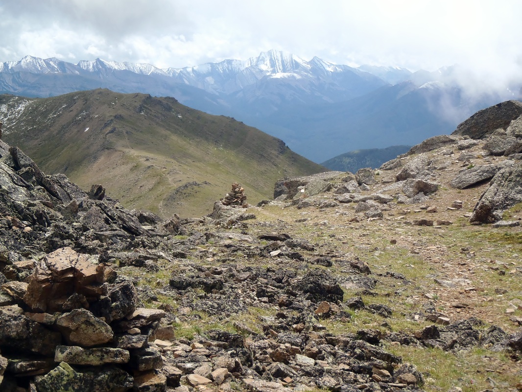
Mount Allen and Olympic Ridge from Ribbon Creek
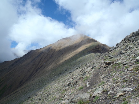
Distance: 11 km to Summit, 19 km to Dead Man's Flats Elevation: 1400 m gain, Summit Elevation 2820 m, 9250 ft. Hiking: The trail ascends steeply through mixed pine and aspen forest, ignoring the switch-backing mine roads which are all heading to the same place for now anyhow, the :mine Scar". This flower filled meadow is almost all that remains of a large coal mine run by the Kananaskis Exploration and Development Company that operated here roughly 70 years ago. From "the Scar", the trail continues its steady upward claim, soon leaving the forest and launching out onto open grass slopes on the southern shoulder of Olympic ridge. Now look up, wayyyyy up, that tiny orange marker you see, that's where your headed. After a kick and a grunt up the end of the ridge, a quick traverse through the forest brings you to a small rock step and the start of a now easier walk across Olympic ridge. The ridge itself is a rocky and windswept Tolkienien landscape, a rambling walk through the Rock Garden followed by a winding trail around The Pinnacles feels like a stroll through another world. Look left for amazing views of the 3 Memorial Lakes, Mount Bogart, and Mount Sparrowhawk. With the final ascent ridge now straight ahead, head for the summit. The angle is reasonable and the footing best along the ridge itself. The peak of Mount Allen offers amazing view of Wind Mountain Mount Lougheed and the Kananaskis Valley as well as Canmore and the Bow River Valley all the way to Banff. From the summit you can continue on down the North Ridge to Dead Man's Flats, head down the very steep northeast ridge to Mount Collembola or head back down the way you came. Other Hikes Nearby: Memorial Lakes, Ribbon Falls, Troll Falls Bike Trails: Skogan Pass, Evan Thomas Paved Trail |
|
History: The Mount Allen Centennial Trail was originally built by the Rocky Mountain Ramblers in the late 60's to commemorate Canada's One Hundredth Birthday as a Nation in 1967. There is a plaque celebrating the event and there efforts on Olympic ridge.
Doctor J.A. Allan was the first professor of Geology at the University if Alberta, he was responsible for locating many coal reserves around Alberta including the one that resulted in the "Mine Scar" |
|
